【基本介绍】
Download and view topographic maps covering Canada.
Topographic maps are useful for recreational activities such as hiking, canoeing, camping, fishing, mountain biking, geocaching, and exploring.
MAPS
Choose from 3 map sources: Canada Base Map (shaded/unshaded), and Toporama.
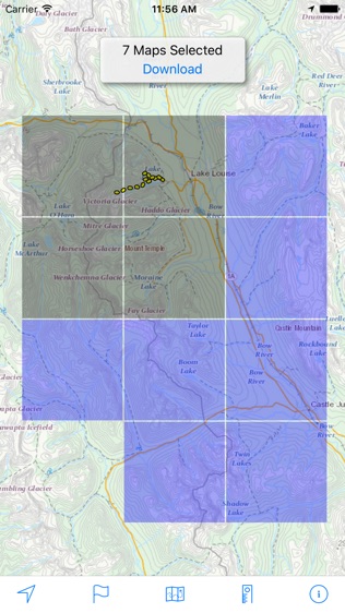
OFFLINE
Download maps for areas of interest to view them later when you don't have
Internet Access or you don't want to use cell data.
TRACKING
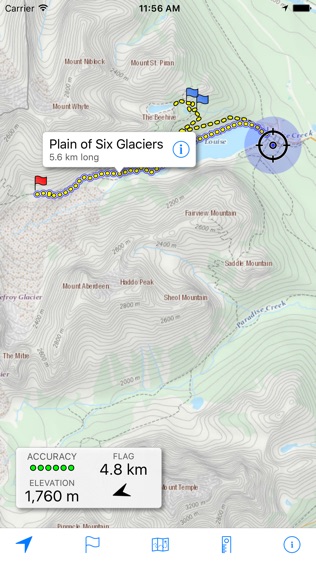
Use location tracking to show where you are on the map, your elevation, and the accuracy of the
gps signal.
FLAGS
Flags are included with map downloads. Add flags (waypoints) to the map to mark your current location or other locations. Import flags from other sources using GPX files and geocache LOC files. Share flags with others using
Email or AirDrop. Organize your flag types by color, for example, geocaches, trailheads, and summits.
TRAILS
Trails are included with map downloads. Import trails (tracks) using GPX files you find on the Internet or from your personal GPS track collection. Share trails with others using email or AirDrop. Organize your trail types by color, for example, mountain bike trails, hiking trails, and OHV trails.
TRAIL RECORDING
Record your own trails to show where you've been on the map, follow them later, and share with others.
ELEVATION PROFILE
Recorded trails include an elevation profile (distance/elevation chart).
NAVIGATION
Navigate to a flag by following the direction arrow that uses your compass heading. Useful for geocaching.
MEASURE
Measure the distance between points on the map.
Note: Continued use of GPS running in the background can dramatically decrease battery life.
【更新日志】
Fixed a bug that prevented trails from appearing on the map for uncommon app update scenarios.